InTDS ArchivebyJacky KaubBuild a back-end with PostgreSQL, FastAPI, and DockerA step-by-step guide to develop a map-based application (Part IV)Mar 14, 20234Mar 14, 20234
InTDS ArchivebyAbdishakurGeoparsing with Python and Natural Language ProcessingExtracting place names and assigning coordinates — TutorialJun 11, 2020Jun 11, 2020
InTDS ArchivebyAdithya KrishnanBuild a geospatial dashboard in Python using GreppoLack of frontend, backend and web-dev experience can be limiting in making a web-app in Python. Not anymore…Feb 23, 20226Feb 23, 20226
InAnalytics VidhyabyRansaka RaviharaHow to create a Choropleth map using Uber H3, Plotly & PythonIn this article, we will build an interactive map that indicates fire ignitions distribution across the Yukon territory.Feb 18, 20212Feb 18, 20212
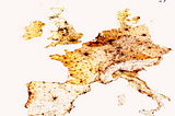
InTDS ArchivebyAdam SymingtonCreating Beautiful Population Density Maps with PythonMapping where the worlds 7.8 billion humans live with PythonFeb 3, 20224Feb 3, 20224
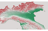
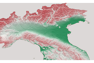
InTDS ArchivebyAdam SymingtonCreating Beautiful Topography Maps with PythonWho needs GIS when you can build eye-catching 3D topography maps with Python?Jan 6, 20224Jan 6, 20224
InTDS ArchivebyFarzin AshouriPostGIS, A Complete WorkflowTackle geospatial challenges with PostGIS in four stepsOct 13, 20215Oct 13, 20215